



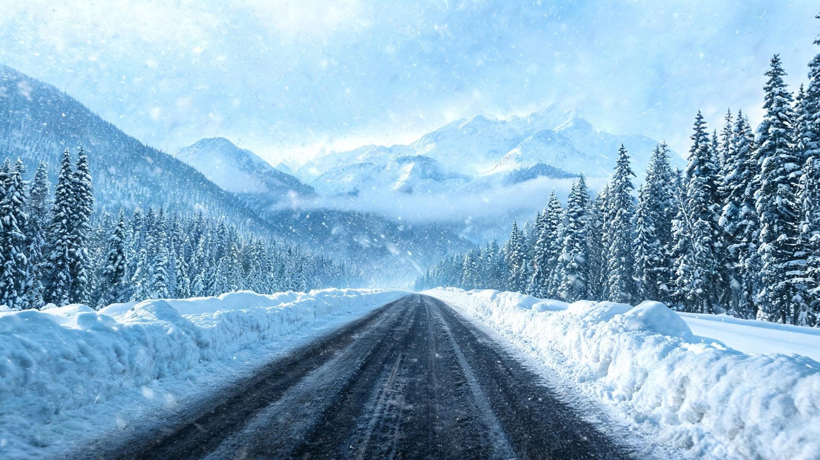
Alaska Interior Snow Warning: Severe Winter Weather Guide
Overview of Interior Alaska Winter Hazards
Interior Alaska represents one of the most climatically extreme regions on the North American continent. Bounded by the majestic Brooks Range to the north and the expansive Alaska Range to the south, this vast subarctic expanse experiences dramatic seasonal transformations. During the protracted winter months, atmospheric conditions can shift rapidly from tranquil, crystalline freeze to severe, multi-day blizzards. When atmospheric moisture collides with bitter Arctic air masses, meteorologists issue an alaska interior snow warning to alert residents, municipal services, and travelers to imminent hazardous snowfall accumulations.
Understanding the mechanisms, operational definitions, and logistical implications of these alerts is vital for anyone living in or traversing the region. Unlike mid-latitude winter storms that feature higher moisture content and moderate cold, subarctic storms present unique physical challenges, including fine-grained powdery snow, extreme wind chill, severe ice fog, and prolonged infrastructure isolation.
| Meteorological Parameter | Standard Advisory Threshold | Warning Level Benchmark | Primary Environmental Impact |
| Heavy Snow Accumulation | 3 to 5 inches within 12 hours | 6+ inches within 12 hours / 8+ inches within 24 hours | Blocked roadways, reduced traction, roof stress |
| Sustained Wind Speed | 15 to 25 miles per hour | Exceeding 35 miles per hour | Ground blizzards, severe drifting, tree damage |
| Prevailing Temperature | 0°F to -20°F | Below -30°F during storm event | Rapid hypothermia, equipment failure, diesel gelling |
| Visibility Standard | 1 to 3 miles | Less than 0.25 miles (whiteout) | Air traffic groundings, highway closures |
| Responsible Forecast Office | NWS Fairbanks (AFG) | NWS Fairbanks (AFG) | Regional alert dispatch via Emergency Alert System |
Meteorological Dynamics of Subarctic Snowfall
The genesis of heavy snowfall across Interior Alaska involves complex interactions between oceanic air masses and topographical barriers. Although the interior basin is inherently semi-arid due to the rain-shadow effect created by the Alaska Range, powerful low-pressure systems originating in the Gulf of Alaska or the Bering Sea occasionally push moist maritime air north over the mountains.
       [ Moist Maritime Air from Gulf of Alaska / Bering Sea ]
                                │
                                ▼
         [ Forced Orographic Lift Over Alaska Range ]
                                │
                                ▼
   [ Deep Atmospheric Moisture Overcomes Subarctic High ]
                                │
                                ▼
  [ Rapid Condensation in Cold Air Mass (-10°F to -30°F) ]
                                │
                                ▼
      [ Heavy Snowfall & High-Density Drift Formation ]
                                │
                                ▼
  [ Official Issuance of an Alaska Interior Snow Warning ]
When this warm, moist air rides over the dense, freezing air trapped in the Tanana, Yukon, or Koyukuk Valleys, overrunning precipitation develops rapidly. Because the cold air near the surface is incredibly dense, the air column achieves saturation efficiently, yielding high snow-to-liquid ratios that often range from 15:1 to as high as 30:1. This results in ultra-light, feathery snow that is exceptionally prone to wind displacement and drifting.
When an alaska interior snow warning is broadcast by the National Weather Service forecast office in Fairbanks, it signifies that atmospheric moisture levels and dynamical lift are sufficient to generate significant, crippling snowfall. These alerts are designed to give remote communities, road maintenance crews, and aviation operators adequate lead time to secure assets and initiate emergency protocols.
Criteria and Official Thresholds for Weather Alerts
The National Weather Service utilizes specific quantitative thresholds to determine when a public hazard advisory must be upgraded to a full warning status. The threshold for issuing an alaska interior snow warning depends heavily on regional climatology, local elevation, and historical preparedness standards.
                     METEOROLOGICAL ALERT ELEVATION PATTERN

  [ Special Weather Statement ] ──> Anticipated weather shifts (24-48 hrs out)
               │
               ▼
   [ Winter Storm Watch ]     ──> High potential for severe snow/wind (12-36 hrs out)
               │
               ▼
  [ Winter Weather Advisory ] ──> 3 to 5 inches expected; moderate travel inconvenience
               │
               ▼
  [ Alaska Interior Snow Warning ] ──> 6+ inches in 12 hrs; life-threatening conditions
Winter Weather Advisory versus Snow Warning
A Winter Weather Advisory is declared when snowfall amounts are expected to cause notable inconvenience, such as slippery roads or minor transit delays, but are not severe enough to stall societal function. Typically, advisory conditions entail accumulations between 3 and 5 inches within a 12-hour period.
Conversely, an official alaska interior snow warning mandates that snowfall will meet or exceed 6 inches within 12 hours, or 8 inches or more within 24 hours. When accompanied by high winds, these warnings may escalate into Blizzard Warnings or Ice Storm Warnings if freezing rain occurs concurrently.
The Role of NWS Fairbanks
The Weather Forecast Office in Fairbanks (AFG) monitors an area covering hundreds of thousands of square miles. Utilizing satellite imagery, Doppler radar data from sites like Pedro Dome, upper-air sounding balloons, and surface mesonet stations, meteorologists track moisture plumes advancing from the Pacific or Bering Strait. When numerical weather prediction models show strong consensus on significant snow volume, the forecasters issue an alaska interior snow warning tailored to specific geographic zones, such as the Yukon Flats, the Middle Tanana Valley, or the Denali Borough.
Geographic Variations Across the Interior Landscape
Interior Alaska covers a vast, diverse topography comprising major river valleys, rolling hills, and rugged mountain passes. As a result, the localized impact of an alaska interior snow warning varies considerably based on microclimate and elevation.
       NORTH: Brooks Range (Cold, High Winds, Heavy Drifting)
                          ▲
                          │
  WEST: Yukon-Koyukuk ◄───┼───► EAST: Upper Tanana / Fortymile
  (Basin Cold Traps)      │     (Continental Extremes)
                          ▼
       SOUTH: Alaska Range / Pass Routes (Orographic Snow)
The Middle Tanana Valley and Fairbanks Metro Area
Fairbanks, North Pole, Ester, and Salcha sit within the low-lying Middle Tanana Valley. This area is known for deep surface temperature inversions during winter, where cold air pools in valley floors under calm conditions. However, when a dynamic storm system pushes through, winds aloft break the inversion, bringing heavy snow and sharp temperature fluctuations. A localized alaska interior snow warning in this zone frequently disrupts urban traffic along the Steese, Elliott, and Parks Highways, creating treacherous ice layers beneath fresh snow accumulation.
The Alaska Range and Highway Passes
Broader alpine corridors such as Isabel Pass on the Richardson Highway and Broad Pass on the Parks Highway experience far more violent winter storm expressions than the valley bottoms. Here, high winds funnel through mountain gaps, compounding heavy snowfall with severe drifting and near-zero visibility. An alaska interior snow warning declared for mountain pass zones almost always implies severe ground blizzard conditions, making long-distance freight shipping and transit hazardous or impossible.
The Yukon Flats and Upper Koyukuk
In northern interior zones, including Fort Yukon, Beaver, Bettles, and Allakaket, snow storms are frequently accompanied by deep arctic cold. Snow particles in these regions are fine and powdery. When an alaska interior snow warning affects these remote off-grid communities, the primary threats center on fuel logistics, heating system resilience, and local air travel shutdowns, which temporarily sever the vital supply chain link to urban distribution hubs.
Infrastructure, Transport, and Economic Impacts
Severe winter weather events exert massive operational pressure on subarctic infrastructure. The built environment in Interior Alaska is engineered to withstand long periods of sub-zero cold, but rapid, heavy snow events create distinct mechanical and structural challenges.
                   SUBARCTIC INFRASTRUCTURE IMPACT SPECTRUM

    Heavy Snow Accumulation ───► Excessive Structural Roof Load
           │
           ├───────────────────► Tree Limb Downfall on Power Lines
           │
           ├───────────────────► Highway Snowbank Encroachment & Lane Narrowing
           │
           └───────────────────► Airport Runway Snow Traps & De-icing Holdovers
Road and Highway Freight Networks
The supply chain of Interior and Arctic Alaska relies heavily on a few primary arterial highways: the Parks Highway connecting Anchorage and Fairbanks, the Richardson Highway extending to Valdez, the Elliott Highway heading north, and the Dalton Highway stretching to the North Slope oil fields.
When an alaska interior snow warning is active, Alaska Department of Transportation & Public Facilities (DOT&PF) crews work around the clock with heavy graders, plows, and snowblowers to maintain traction and clear lanes. Heavy accumulation combined with high winds can lead to rapid drift build-up on steep grades like Atigun Pass, resulting in temporary highway closures that halt commercial freight operations.
Aviation Hazards and Remote Supply Lines
Air travel is the lifeline for dozens of rural communities in Interior Alaska that lack road connections. Small turboprop aircraft and cargo planes deliver mail, food, medical supplies, and passenger transit to remote airstrips.
  [ Severe Snow Warning Issued ]
               │
               ▼
  [ In-Flight Icing Conditions & Reduced Runway Visual Range ]
               │
               ▼
  [ Cancellation of Essential Air Mail & Cargo Flights ]
               │
               ▼
  [ Off-Grid Community Supply Delays & Resource Conservation ]
When an alaska interior snow warning is in effect, airports experience ground stops, poor braking action on gravel runways, and severe in-flight icing risk. Prolonged storms lasting three to five days can exhaust perishable inventories in village stores, underscoring the necessity of local stockpiling.
Structural Loading and Power Grid Integrity
Subarctic snow varies in density. Early-season or mid-winter storms that occur near freezing temperatures (around 28°F to 32°F) deposit wet, heavy snow that clings to structural elements and power lines. The heavy accumulation causes birch and spruce trees to bend and break over distribution wires, triggering widespread electrical outages. Heating systems rely on electricity to power pumps and blowers; therefore, power loss during an alaska interior snow warning requires immediate backup power generation to prevent residential water pipes from freezing and bursting.
Survival Strategies and Household Preparedness
Living in Interior Alaska demands a high baseline of personal self-reliance and winter preparedness. When public alerts indicate an impending heavy snowfall event, residents execute well-established safety routines to safeguard their homes, vehicles, and families.
┌─────────────────────────────────────────────────────────────────────────┐
│                    ESSENTIAL WINTER EMERGENCY KIT                       │
├─────────────────────────────────────────────────────────────────────────┤
│ 1. Heating Fuel: Minimum 2-week supply of heating oil/firewood         │
│ 2. Backup Power: Dual-fuel generator with tested transfer switch       │
│ 3. Water Reserves: 1 gallon per person/day (stored in heated space)    │
│ 4. Food Supplies: Non-perishable, high-calorie food options            │
│ 5. Emergency Lighting: Headlamps, lanterns, and spare lithium batteries│
│ 6. Vehicle Recovery Gear: Tow strap, shovel, traction boards, sand     │
│ 7. Extreme Cold Wear: Rated parkas, insulated boots, rabbit-lined mitts│
└─────────────────────────────────────────────────────────────────────────┘
Winterizing the Household
Homeowners across the Interior maintain specific preparations before and during a severe storm:
- Heating Fuel Management: Ensuring fuel oil tanks are topped off and dry wood stacks are easily accessible under protective tarps.
- Backup Generator Testing: Running outdoor standby generators to ensure carburetors are clear and battery starters function in extreme cold.
- Vent Clearance: Clearing snow accumulation around fuel oil, propane, and direct-vent heating exhausts to eliminate the danger of carbon monoxide backing up into living quarters.
- Freeze Protection: Keeping interior cabinet doors open under sinks to allow ambient heat to circulate around plumbing fixtures during power outages.
Vehicle Equipment and Emergency Kits
Driving during an alaska interior snow warning is discouraged unless absolutely necessary. However, if travel cannot be avoided, vehicles must be outfitted for subarctic survival:
[ Vehicle Pre-Trip Checks ] ──> Engine Block Heater Plugged In?
                             ──> Tire Pressure Adjusted for Cold drop?
                             ──> Fuel Tank At Least 3/4 Full?
                             ──> Emergency Winter Kit Stowed?
A standard vehicle winter kit in the Alaska Interior includes:
- Sub-zero rated sleeping bags (-20°F or colder)
- High-efficiency snow shovel and collapsible saw
- Tow strap rated for heavy vehicles
- Traction aids (sand, cat litter, or recovery boards)
- Satellite communication device (such as an InReach or satellite phone)
- Portable jump-starter pack with cold-weather lithium cells
- High-energy rations and insulated thermos with hot liquids
If a vehicle slides off the road during an active alaska interior snow warning, remaining inside the vehicle is standard protocol. Leaving the car during a storm with low visibility increases the risk of disorientation and rapid hypothermia. Running the engine for ten minutes every hour for heat while ensuring the exhaust pipe remains clear of snowdrift prevents carbon monoxide buildup.
Historic Interior Alaska Snowfall Events
To understand the modern operational response to an alaska interior snow warning, it is useful to review landmark winter storm events that have shaped regional emergency planning and building codes.
 HISTORICAL SNOWFALL EVENT TIMELINE (INTERIOR ALASKA)

 1966: Great Thanksgiving Blizzard ──> Over 3 feet of snow across Fairbanks; citywide shutdown
 1992: Early October Megastorm   ──> Early season wet snow breaks thousands of trees & power lines
 2010: December Arctic Overrun   ──> Extreme temperature drop following 24 inches of snowfall
 2021: Record December "Icemageddon" ──> Heavy snow followed by torrential freezing rain; state disaster
The Thanksgiving Storm of 1966
One of the most famous winter storms in Interior Alaska history occurred during Thanksgiving week in 1966. A massive, moisture-laden Pacific storm pushed over the Alaska Range, dropping more than three feet of dense snow over Fairbanks and surrounding communities within 48 hours. The storm paralyzed ground transportation, trapped residents in their homes, and prompted a coordinated military and civilian recovery effort using heavy tracked vehicles to clear main thoroughfares.
The October 1992 Early-Season Snowfall
In early October 1992, before trees had fully shed their foliage and before ground temperatures had dropped to typical mid-winter levels, a intense storm system dumped over two feet of wet, heavy snow across the Middle Tanana Valley. The unseasonal weight of the snow caused widespread collapse of deciduous trees across power corridors, leaving over 80 percent of the Fairbanks North Star Borough without electricity for multiple days. This event fundamentally changed how local utilities manage right-of-way clearing around high-voltage transmission lines.
The December 2021 Severe Weather Sequence
In late December 2021, a complex atmospheric river event brought record-breaking precipitation to Interior Alaska. The system began with heavy snow accumulation that triggered a regional alaska interior snow warning, followed by an unprecedented surge of warm air that raised temperatures above freezing and delivered torrential rain.
[ Phase 1: Heavy Snowfall ] ──> 12-18 Inches Powder Deposit
            │
            ▼
[ Phase 2: Rapid Warming ]  ──> Temperature Climbs to 38°F
            │
            ▼
[ Phase 3: Torrential Rain ] ──> Rain Saturates Existing Snow Pack
            │
            ▼
[ Phase 4: Sudden Flash Freeze ] ──> Concrete-like Ice Layer Traps Interior Roads
The rain saturated the fresh snow layer before temperatures plummeted back below zero, creating a thick, rock-hard layer of ice over roads, driveways, and natural forage areas. The Governor declared a state disaster as emergency crews worked for weeks to chip away ice armor from highways and restore power to isolated sub-regions.
Scientific Analysis of Changing Subarctic Climate Patterns
Meteorologists and climate researchers at the University of Alaska Fairbanks (UAF) and the International Arctic Research Center (IARC) actively study how shifting global climate patterns influence the frequency and severity of winter storms in the subarctic.
       GLOBAL WARMING / ARCTIC AMPLIFICATION
                         │
                         ▼
        [ Increased Sea Surface Temperatures ]
                         │
                         ▼
        [ Higher Moisture Capacity in Atmosphere ]
                         │
                         ▼
   [ Frequency of Heavy Snow / Freezing Rain Events Up ]
                         │
                         ▼
   [ Escalated Frequency of Alaska Interior Snow Warning Alerts ]
Increased Atmospheric Moisture Content
As sea-ice extent in the Bering and Chukchi Seas decreases during late autumn and early winter, more open water is exposed to the atmosphere. This open water releases thermal energy and moisture into air masses moving across the state. Consequently, when storm systems move inland, they carry significantly higher precipitable water values than was typical in past decades.
Rising Frequency of Compound Events
Historically, interior winter storms delivered cold, dry snow. In recent years, researchers have documented a higher frequency of compound weather events where an alaska interior snow warning is combined with or immediately followed by freezing rain, high winds, or rapid thaw-freeze cycles. These mixed-phase winter storms present unprecedented challenges for wildlife, such as caribou and moose, which struggle to crater through thick ice crusts to access lichen and willow branches.
Frequently Asked Questions
What officially triggers an alaska interior snow warning?
An alaska interior snow warning is issued by the National Weather Service when snowfall amounts are expected to reach or exceed 6 inches within a 12-hour period, or 8 inches or more within a 24-hour period. The warning indicates that heavy snow will make travel difficult or impossible and may create hazardous conditions for life and property.
How does a snow warning differ from a blizzard warning in Alaska?
While a snow warning focuses primarily on heavy snow accumulation, a Blizzard Warning requires two additional criteria: sustained winds or frequent gusts of 35 miles per hour or greater, and falling or blowing snow that reduces visibility to less than a quarter-mile for a sustained period of at least three hours. Temperatures during a blizzard can vary, but the combination of wind and low visibility creates extreme hazard levels.
What precautions should motorists take when a snow warning is active?
When an alaska interior snow warning is active, motorists should avoid non-essential travel. If driving is unavoidable, vehicles should be equipped with winter tires, a full tank of fuel, sub-zero cold-weather gear, a snow shovel, tow straps, emergency rations, and a satellite communication device. Drivers must inform someone of their route and expected arrival time before departure.
Why do snow warnings in Interior Alaska often involve very light, powdery snow?
Due to the extremely low surface temperatures typical of the subarctic interior (often well below 0°F), ice crystals form with high snow-to-liquid ratios (such as 20:1 or 30:1). This creates light, dry, feathery powder. While easier to shovel, this light snow is easily picked up by ambient winds, causing severe blowing snow and drifting across highways.
Where can travelers find real-time road and weather alerts for Interior Alaska?
Travelers can access up-to-the-minute road condition reports through the Alaska 511 system via phone or online dashboard. Weather alerts, radar imagery, and specialized winter forecasts are maintained continuously by the National Weather Service Forecast Office in Fairbanks.
Navigating the Subarctic Winter: Long-Term Resilience
The experience of living in Interior Alaska is defined by a deep respect for natural forces. An alaska interior snow warning is not merely an abstract weather bulletin; it is an imperative call to action that mobilizes municipal road crews, energy utilities, rural air operators, and individual households.
Through a combination of modern meteorological forecasting, robust infrastructure design, community-level cooperation, and individual preparedness, residents of the Last Frontier continue to adapt to some of the most challenging winter environments on Earth. As climate patterns evolve and atmospheric moisture dynamics shift, the precision of weather forecasting and the speed of emergency communication will remain essential pillars of safety, resilience, and daily life across Interior Alaska.